


Franklin County PUMA, Missouri
About
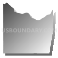
Outline

Summary
| Unique Area Identifier | 193300 |
| Name | Franklin County PUMA |
| State | Missouri |
| Area (square miles) | 930.69 |
| Land Area (square miles) | 922.68 |
| Water Area (square miles) | 8.00 |
| % of Land Area | 99.14 |
| % of Water Area | 0.86 |
| Latitude of the Internal Point | 38.40831250 |
| Longtitude of the Internal Point | -91.07340980 |
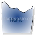
Maps


Graphs
Select a template below for downloading or customizing gragh for Franklin County PUMA, Missouri


Neighbors
Neighoring Public Use Microdata Area (by Name) Neighboring Public Use Microdata Area on the Map
- Jefferson County (South) PUMA, MO
- Lincoln, Warren, Audrain, Pike & Montgomery Counties PUMA, MO
- Phelps, Crawford, Dent, Gasconade & Maries Counties PUMA, MO
- St. Charles County (South) PUMA, MO
- St. Francois, Washington, Perry & Ste. Genevieve Counties PUMA, MO
- St. Louis County (South) PUMA, MO
- St. Louis County (West) PUMA, MO
Top 10 Neighboring County (by Population) Neighboring County on the Map
- St. Louis County, MO (998,954)
- St. Charles County, MO (360,485)
- Jefferson County, MO (218,733)
- Franklin County, MO (101,492)
- Warren County, MO (32,513)
- Washington County, MO (25,195)
- Crawford County, MO (24,696)
- Gasconade County, MO (15,222)
Top 10 Neighboring County Subdivision (by Population) Neighboring County Subdivision on the Map
- Boone township, St. Charles County, MO (41,639)
- Meramec township, St. Louis County, MO (39,731)
- Chesterfield township, St. Louis County, MO (38,982)
- Meramec township, Jefferson County, MO (18,192)
- Boles township, Franklin County, MO (18,108)
- Union township, Franklin County, MO (17,940)
- Central township, Franklin County, MO (14,054)
- Washington township, Franklin County, MO (13,982)
- Meramec township, Franklin County, MO (9,382)
- Big River township, Jefferson County, MO (6,597)
Top 10 Neighboring Place (by Population) Neighboring Place on the Map
- Wildwood city, MO (35,517)
- Washington city, MO (13,982)
- Union city, MO (10,204)
- Sullivan city, MO (7,081)
- Pacific city, MO (7,002)
- St. Clair city, MO (4,724)
- Gray Summit CDP, MO (2,701)
- Villa Ridge CDP, MO (2,636)
- New Haven city, MO (2,089)
- LaBarque Creek CDP, MO (1,558)
Top 10 Neighboring Elementary School District (by Population) Neighboring Elementary School District on the Map
- Lonedell R-XIV School District, MO (3,476)
- Spring Bluff R-XV School District, MO (1,752)
- Richwoods R-VII School District, MO (1,651)
- Franklin County R-II School District, MO (1,383)
- Strain-Japan R-XVI School District, MO (893)
Top 10 Neighboring Unified School District (by Population) Neighboring Unified School District on the Map
- Rockwood School District, MO (116,321)
- Francis Howell School District, MO (113,553)
- Northwest R-I School District, MO (45,694)
- Washington School District, MO (31,485)
- Meramec Valley R-III School District, MO (22,762)
- Union R-XI School District, MO (19,974)
- Warren County R-III School District, MO (18,599)
- St. Clair R-XIII School District, MO (12,448)
- Gasconade County R-II School District, MO (11,820)
- Sullivan School District, MO (11,771)
Top 10 Neighboring State Legislative District Lower Chamber (by Population) Neighboring State Legislative District Lower Chamber on the Map
- State House District 99, MO (42,788)
- State House District 98, MO (38,996)
- State House District 89, MO (38,194)
- State House District 110, MO (37,588)
- State House District 150, MO (36,107)
- State House District 109, MO (35,780)
- State House District 111, MO (35,531)
- State House District 105, MO (35,379)
- State House District 112, MO (34,350)
Top 10 Neighboring State Legislative District Upper Chamber (by Population) Neighboring State Legislative District Upper Chamber on the Map
- State Senate District 2, MO (242,885)
- State Senate District 26, MO (189,096)
- State Senate District 16, MO (188,295)
- State Senate District 22, MO (176,515)
- State Senate District 3, MO (174,508)
Top 10 Neighboring 111th Congressional District (by Population) Neighboring 111th Congressional District on the Map
- Congressional District 2, MO (706,622)
- Congressional District 9, MO (684,101)
- Congressional District 8, MO (656,894)
- Congressional District 3, MO (625,251)
Top 10 Neighboring Census Tract (by Population) Neighboring Census Tract on the Map
- Census Tract 8001, Franklin County, MO (8,584)
- Census Tract 8006.02, Franklin County, MO (8,402)
- Census Tract 8008, Franklin County, MO (7,649)
- Census Tract 8202.02, Warren County, MO (7,508)
- Census Tract 8003, Franklin County, MO (7,476)
- Census Tract 8007.01, Franklin County, MO (7,308)
- Census Tract 2215.03, St. Louis County, MO (7,235)
- Census Tract 8005, Franklin County, MO (7,201)
- Census Tract 8004.02, Franklin County, MO (6,905)
- Census Tract 8006.01, Franklin County, MO (6,903)
Top 10 Neighboring 5-Digit ZIP Code Tabulation Area (by Population) Neighboring 5-Digit ZIP Code Tabulation Area on the Map
- 63304, MO (40,336)
- 63090, MO (21,524)
- 63005, MO (17,753)
- 63084, MO (17,414)
- 63069, MO (15,647)
- 63080, MO (13,987)
- 63077, MO (11,798)
- 65453, MO (8,548)
- 63038, MO (6,914)
- 65066, MO (6,703)